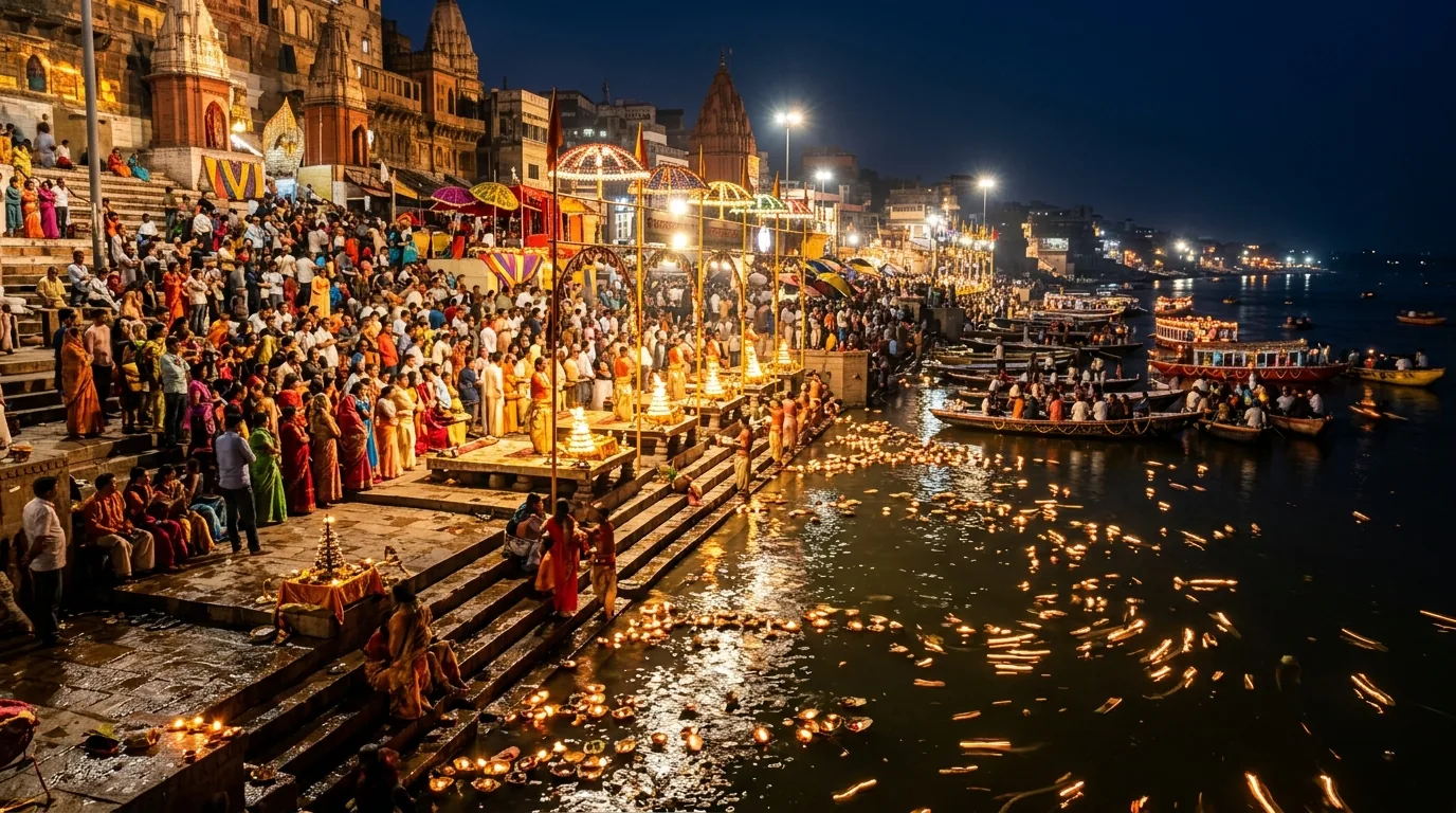
Walking from Assi to Dashashwamedh lets you experience Varanasi at the pace of its riverfront. Boats are being prepared, people come down for a bath or prayer, and the names on the ghats gradually change as you move from the southern neighbourhoods into the busy centre.
It is a walk of roughly three kilometres when a reasonably direct riverfront connection is usable. That is an approximate planning length, not a surveyed trail measurement. Allow around 60–90 minutes for steady movement and two to three hours if you want to stop. Steps, crowding, temple visits and seasonal diversions can add substantially to both distance and time.
Route overview: walk north with the river on your right
Begin at Assi Ghat and head north towards Tulsi Ghat. For this direction of travel, the Ganga generally remains on your right. Continue through the southern ghat neighbourhoods towards the Chet Singh and Shivala area, then Harishchandra and Kedar, before reaching the palace-fronted central ghats and Dashashwamedh.
The route is a sequence of stone terraces, steps and connections. It is not one continuous flat promenade. Sometimes you can stay at a similar level across adjoining ghats; elsewhere you climb and descend to find the usable passage.
| Route section | Landmarks to recognise | What to allow for |
|---|---|---|
| Assi to Tulsi/Bhadaini | Assi's open gathering area, Tulsi Ghat and Bhadaini's riverfront | Morning activity and the first changes of level |
| Southern middle stretch | Janki-side ghats, then the Chet Singh/Shivala area | Smaller terraces, local worship and steps |
| Harishchandra area | An active cremation ghat | A clear respectful passage, or an inland bypass |
| Kedar and nearby ghats | Kedareshwar temple area and bathing steps | Worshippers, wet surfaces and possible temple detours |
| Palace-fronted central stretch | Chausatti, Darbhanga and Munshi-side riverfront | Photographs from clear standing places and more visitors |
| Final approach | Ahilyabai/Sheetla area and Dashashwamedh | Increasing activity, especially before evening aarti |
This table groups landmarks for orientation rather than listing every ghat. When an on-site sign or local instruction conflicts with a map line, follow the currently usable pedestrian route.
Leave Assi after choosing your morning priority
Assi is an easy place to spend longer than planned. If you are attending Subah-e-Banaras, decide whether to stay for the complete programme, have breakfast and then walk, or make the riverfront walk your main early activity. Both are reasonable; trying to do everything at once is what creates the rush.
Check conditions before descending to a lower terrace. Ask whether the connection towards Tulsi and the central ghats is open, especially after rain or a period of high water. A visible dry stretch immediately beside Assi does not prove that the whole route is passable.
Carry a small water bottle, secure your phone or camera, and use footwear with dependable grip. Loose sandals that are comfortable on a hotel floor may be awkward on irregular steps. Keep both hands available where the surface is steep or slippery.
If walking with children, establish the river-side boundary before starting. Choose pauses on broad upper terraces instead of stopping close to moored boats or the water. Our Assi Ghat guide helps with the start point and the morning programme.
Tulsi, Bhadaini and the Chet Singh–Shivala stretch
Tulsi Ghat carries associations with Tulsidas and the literary and devotional traditions of Kashi. Treat those associations as part of the neighbourhood's cultural memory. You do not need to add a long historical tour to appreciate the change from Assi's open gathering space to smaller working ghats.
Around Bhadaini and the following terraces, look ahead for the next clear connection rather than automatically staying on the lowest line. Bathing, washing and boat work share this space. Give people room, and ask before photographing anyone at close range.
The Chet Singh and Shivala area offers some of the route's most recognisable built riverfront. Pause where you can stand without interrupting steps or entrances. A striking facade is not an invitation to enter a private building, climb a wall or step onto an uncertain ledge for a photograph.
This stretch is also a sensible place to assess stamina. You do not have to continue to Dashashwamedh simply because you started at Assi. If someone needs to stop, take an appropriate upper-lane exit and arrange onward travel from a reachable road point. Ask for the route before committing to a steep climb with an exhausted companion.
Harishchandra Ghat: pass with care and discretion
Harishchandra is an active cremation ghat. It is not an ordinary sightseeing stop within an otherwise scenic walk. Funeral activity may affect where visitors can pass, and mourners and workers always take priority over a through-route.
Keep cameras and phones lowered. Do not photograph bodies, pyres, mourners or cremation work. Avoid pausing in a working corridor for explanations, and never step over timber, ritual materials or a funeral procession to maintain your walking line.
If there is a clearly open passage away from the activity, move through quietly. If the route is unclear, crowded or uncomfortable for your group, ask for an upper-lane bypass before entering the working space. A map should never be used as a reason to walk through a restricted area.
Explain the possibility to children beforehand in simple language. Some families will prefer to leave the riverfront before this stretch and rejoin further north. That is a valid route choice. The aim is a considerate journey through a living city, not completing every metre beside the water.
Kedar to Dashashwamedh: temples, palaces and a busier finish
Kedar Ghat is associated with Kedareshwar worship and is an important place of prayer and bathing. Watch for wet steps and people moving between the river and temple approaches. If adding a temple visit, count the footwear, queue and return climb as part of the outing.
Continue north through the adjoining ghats towards the central palace-fronted stretch. Darbhanga and Munshi are useful landmarks, while the changing facades make this a rewarding place for photographs. Stop completely before framing a shot rather than walking backwards towards the water.
As you approach Dashashwamedh, pedestrian activity increases. Boats, vendors, worshippers and people finding aarti viewing places all compete for room. Finish the walking route before you begin deciding where to sit for a ceremony; the last few ghats are not a convenient place to spread out a group and consult several phones.
If evening Ganga Aarti is the plan, add a separate arrival buffer after the walk. Our aarti arrival guide explains how to calculate backwards from the locally confirmed start. A three-hour sightseeing walk ending exactly at ceremony time is not an early-arrival plan.
Steps, heat and seasonal diversions
There is no reliable fixed step count for this walk. The number changes with the level you use, temple detours, local closures and the chosen entrances or exits. Avoid guides promising a precise total unless they identify a specific surveyed route and date. For practical purposes, expect repeated climbing and descending.
During high water, lower connections may disappear. After water recedes, silt, algae and cleaning work can still make the exposed terraces difficult. A route shown in a dry-season photograph does not establish safe passage during monsoon conditions.
When a connection is closed, climb only by an open established stairway and ask for the usable inland link. The Assi, Shivala, Harishchandra/Sonarpura and Kedar neighbourhoods provide orientation points for seeking road-side routes, but they do not form one guaranteed continuous upper promenade. You may need a longer detour or a vehicle journey around the restricted centre.
Do not wade through a flooded connection, balance along a narrow wet edge or accept a boat transfer as automatically necessary. Boat operations also depend on current permissions and conditions. If the riverfront is closed in several places, choose a shorter neighbourhood walk and visit Dashashwamedh separately.
In summer, an early start helps reduce exposure, but the stone can still become hot as the morning advances. In winter, low light and mist may make the first steps harder to judge. Wait until you can see clearly rather than making a predawn start a matter of pride.
Rest stops, return travel and a shorter alternative
Plan breaks before you need them. Use established cafes or other appropriate venues reached by a clear exit, and ask about toilets before relying on them. There is no verified promise of an open public toilet at every stage of the walk.
For a shorter outing, walk Assi to the Chet Singh/Shivala area and finish inland. Another option is to begin around Kedar and walk only the central stretch to Dashashwamedh. These versions preserve the riverfront experience while reducing the total effort.
The return does not have to repeat the route. Walk inland to a currently accessible pickup point, using local directions for road restrictions, and arrange an auto or cab back. A boat return is a separate paid service whose operating status, boarding point, fare and life jackets should be checked before boarding.
Keep the rest of the day light if you have spent several hours on the ghats. Save the Dashashwamedh to Manikarnika walk for another time if the group is tired. Continuing north because the next landmark looks close can turn an enjoyable morning into a much longer outing than anyone agreed to.
BEFORE YOU GO
Frequently asked questions
How long is the Assi to Dashashwamedh walk?
Use roughly three kilometres as an approximate planning length for a reasonably direct riverfront connection. Allow around 60–90 minutes of steady movement or two to three hours with stops. Detours, steps, crowds and temple visits can extend the route considerably.
Can I stay beside the river for the whole walk?
Only when the adjoining ghat connections are open and usable. Changes in level are normal, and high water, works or funeral activity may require an inland bypass. Do not assume that a route visible on a map is continuously accessible on your travel date.
Is this a flat or wheelchair-friendly promenade?
No continuous step-free route is established by this guide. Expect irregular surfaces and repeated stairs. Visitors who need step-free access should check a specific short section and its entrance in advance, or arrange individual visits with suitable transport instead of attempting the full walk.
Do I have to pass through cremation activity?
The route reaches the Harishchandra area, where cremations take place. Use only a clearly open passage away from the work, or ask for an inland bypass. Never cross pyres, materials or a funeral procession to preserve a riverside route.
Can I do this walk during monsoon?
Conditions decide. Lower paths may be submerged, and exposed steps can remain slippery after the water drops. Confirm access locally and shorten or replace the walk when needed. Never wade across a closed connection or assume boats can operate during restrictions.
REFERENCE NOTES
Sources and practical updates
These primary sources support the factual background of this guide. For your travel dates, confirm the current arrangements with the responsible venue, property or service provider.
- Ministry of Tourism, Incredible India: riverfront walking landmarks and Harishchandra context
- Kashi government portal: Kedar Ghat and Kedareshwar worship
- Kashi government portal: Dashashwamedh setting
- Ministry of Tourism, Incredible India: Dashashwamedh and Assi visitor context